Land Surveying
Professionals Arabia Co.'s surveying division delivers precise geospatial data to support construction and infrastructure projects. Advanced equipment ensures reliable measurements for engineering and design.
Book Now
✽ What We Offer
Advanced Land Survey & Geospatial Analysis Services
Topographic surveys
Conducting detailed mapping of the land’s physical features, including slopes, elevations, natural obstacles, and existing structures, to support accurate planning and design decisions for construction projects.
Boundary and cadastral surveys
Precisely defining property lines and legal boundaries to ensure compliance with regulations, prevent disputes, and establish ownership limits before development begins.
Construction staking and layout
Providing on-site guidance for the placement of buildings, roads, and other structures by marking reference points, ensuring that construction follows the approved design and layout accurately.
As-built surveys
Documenting completed work to create an accurate record of the constructed project, which serves as a reference for future maintenance, renovations, or expansions.
3D laser scanning and modeling
Utilizing advanced laser scanning technology to capture detailed, high-resolution three-dimensional data of the site, enabling precise modeling, clash detection, and design validation before and during construction.
Benchmark installation
Establishing permanent reference points and elevation markers across the site to provide consistent, reliable measurements for surveying, construction, and quality assurance purposes.


Land Surveying Equipments
Professionals Arabia Co. provides high-precision surveying equipment designed to deliver accurate measurements and reliable data for every phase of your project.

E Survey GPS Model E-800
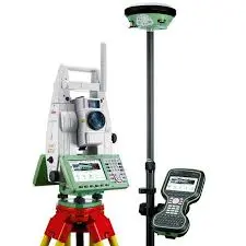
Total Stations Leica Models (T607, T607, T609, T611)
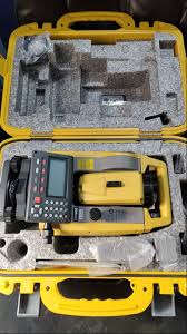
Total Stations Topcon
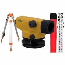
Auto Level Machine

Laser Level Machine
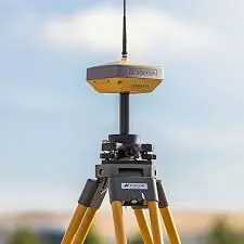
Topcon GPS Models (Hyper VR, Hyper V & GR5)
Prepared to take the next step in your land development journey?
Let us provide the expertise you need. Reach out today to secure dependable land surveying services that support your project's long-term success.